
Hakone Hachiri Complete Guide: Odawara to Mishima
Hakone Hachiri is the mountain section of the Old Tokaido highway between Odawara and Mishima. It crosses the Hakone ridge through post towns, stone paving, cedar avenues, teahouses and the historic checkpoint beside Lake Ashi.
The complete route is approximately 32 km, or eight ri. One ri is roughly four kilometres. This is much longer than the popular Old Tokaido walk between Hakone-Yumoto and Lake Ashi, so it is important not to confuse the two when planning.
This guide explains the full route, its Edo-period history, the east and west slopes, realistic walking options and how to experience the highlights without attempting all 32 km in one day.
Last route-information review: July 16, 2026. Always check official trail and transport information immediately before walking.
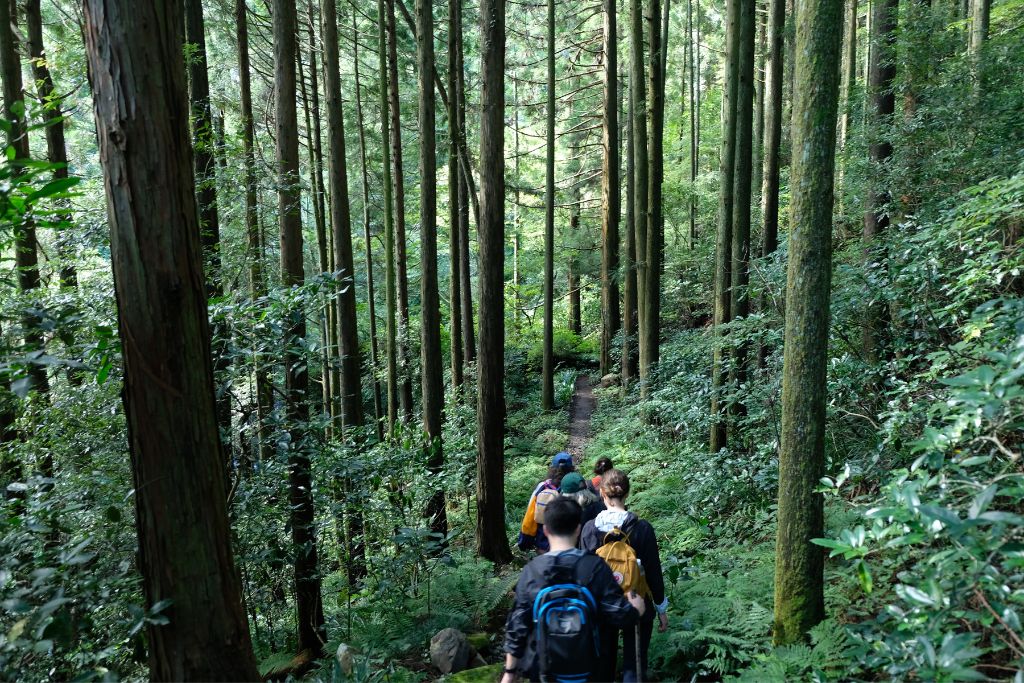
Hakone Hachiri at a glance
| Historic endpoints | Odawara Post Town to Mishima Post Town |
|---|---|
| Total distance | Approximately 32 km (eight ri) |
| Highest point | Hakone Pass, approximately 846 m |
| Official complete-route time | About 9 hr 50 min, excluding breaks |
| Difficulty | Very difficult as one continuous day; manageable as selected stages |
| Best-known features | Stone paving, Amazake Chaya, Lake Ashi, cedar avenue, Hakone Checkpoint, Yamanaka Castle and Mishima |
The official Hakone Hachiri guide rates the complete route at its highest difficulty and recommends a two-day sightseeing itinerary for most visitors. The quoted walking time does not include meals, museum visits, photographs, wrong turns or waiting for transport.
What does “Hakone Hachiri” mean?
Hachiri means eight ri. The name describes the roughly 32 km between the former Odawara and Mishima post towns. The route climbs from near sea level on either side to the Hakone ridge, reaching about 846 m at Hakone Pass.
Hakone Hachiri is one part of the much longer Tokaido, the highway linking Edo with Kyoto. The Tokugawa government formalised the Tokaido post-station system in 1601. Hakone Post Town was created in 1618 between Odawara and Mishima to support traffic over this difficult mountain crossing.
Today you will see several names used for overlapping places:
- Old Tokaido: the historic highway as a whole, or preserved local sections of it.
- Hakone Hachiri: the complete Odawara–Hakone–Mishima mountain section.
- Hakone Kyu Kaido: the “old Hakone highway,” often referring to the popular east-side route near Hakone-Yumoto, Hatajuku and Lake Ashi.
If you only want the east-side stone route, read the Old Tokaido Road hike guide.
Why Hakone Hachiri became Japan Heritage
The route was recognized as Japan Heritage in 2018. Its importance is not based on one monument. The entire corridor preserves the elements of an Edo-period journey: a castle town, post towns, milestones, teahouses, stone pavement, roadside trees and an official checkpoint.
Hakone was also a defensive landscape. Official heritage material explains that the east slope used valleys while the west slope followed ridges, reflecting the shogunate’s concern with protecting Edo. Travelers included feudal lords on official journeys, foreign delegations, officials and ordinary pilgrims.
Why the road was paved with stone
Mountain rain turned the earlier surface into deep mud. The road was paved with stone in 1680 to make travel more reliable. The result is beautiful but physically demanding: irregular stones can be tiring when dry and slippery when wet.
Milestones, cedars and the checkpoint
Milestones marked each ri, roadside trees gave shelter, and the checkpoint controlled movement through the mountains. Near Lake Ashi, these features sit close together, making the central Hakone section the easiest place to understand how the old highway worked.
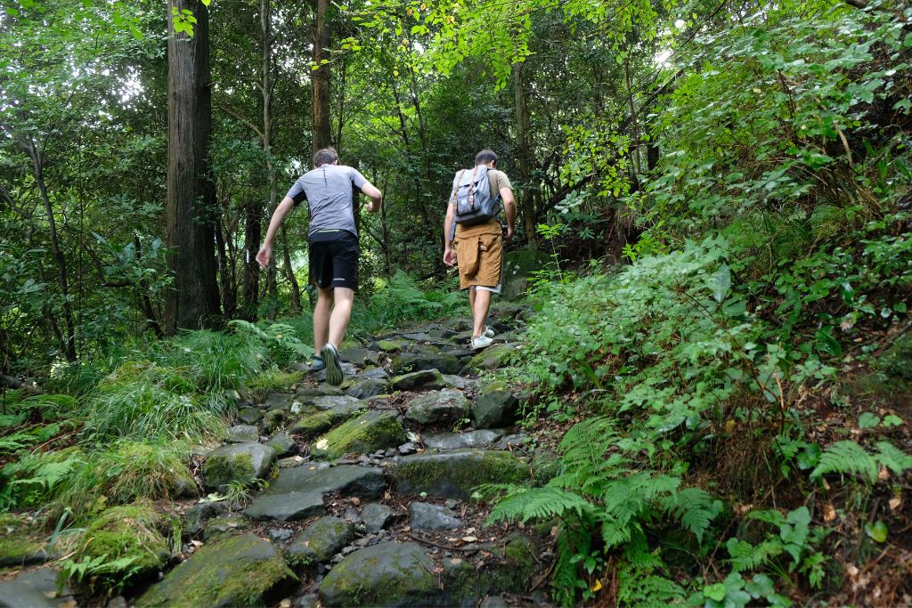
Turn the Hakone Hachiri history into a guided day
Aki selects the sections that suit your group instead of treating every road kilometre as compulsory.
Route section 1: Odawara to Hakone-Yumoto
Odawara was the ninth post town from Edo and the place where many travelers prepared for the mountain crossing. The official heritage walking course from Odawara Station to Hakone-Yumoto is approximately 7 km and takes about three hours with breaks.
This is the least mountainous section. It connects Odawara Castle, traditional streets, local crafts and food culture before reaching Hakone-Yumoto. Walk it for historical context rather than remote trail scenery.
Route section 2: Hakone-Yumoto to Lake Ashi
The official complete east-slope course begins near Sanmaibashi and climbs approximately 13 km to the Lake Ashi and checkpoint area. Official figures give about four hours of ascent before breaks, with approximately 640 m of elevation difference.
Highlights include Hatajuku and its yosegi woodcraft, surviving cobblestones, Amazake Chaya, cedar forest and the approach to Lake Ashi. Aki recommends walking from Hakone-Yumoto toward the lake when doing the east side.
Aki’s safety advice for the east slope
Do not force yourself to walk the steep traffic-exposed roadside section simply to cover every metre. Take the bus past this unpleasant section and begin a shorter walk at Amazake Chaya. This avoids climbing beside moving vehicles and breathing exhaust fumes, while preserving the best cobblestones, forest and Lake Ashi experience.
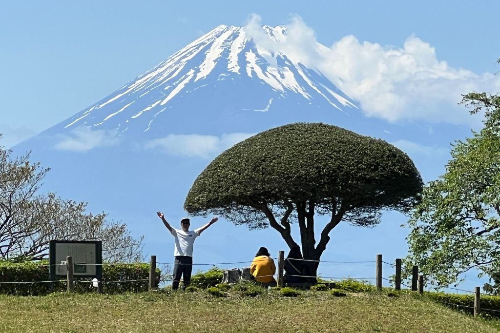
Route section 3: Lake Ashi to Mishima
The west slope crosses Hakone Pass and descends toward Mishima. The official course between the Hakone Checkpoint and Mishima Taisha is approximately 13.9 km. It lists about 4 hr 30 min downhill or 5 hr 30 min uphill, excluding breaks, with roughly 800 m of elevation difference.
This side feels different from the east. It includes ridge landscapes, sections of stone road, Mt Fuji viewpoints, the remains of Yamanaka Castle, milestones and the long descent toward Mishima.
Yamanaka Castle
The castle ruins sit on the historic corridor between Hakone and Mishima. Earthworks and defensive features survive without a reconstructed keep. This is Aki’s favourite historical stop on the west side, so allow time to understand the site rather than treating it as only a trail marker.
Finishing in Mishima
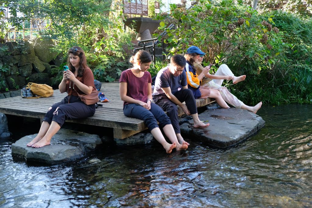
Mishima grew around Mishima Taisha and became the eleventh post town from Edo. Travelers arriving from the east are said to have celebrated completing the mountain crossing. The city’s waterways and station connections make it a practical finish. Soaking tired feet beside the clear Genbe River is another of Aki’s favourite parts of the west-side tour and a refreshing way to end the walk.
Can you walk all 32 km in one day?
Experienced fast hikers or trail runners may complete Hakone Hachiri in a single long day. The official estimate is about 9 hr 50 min without breaks, and the route involves navigation, road crossings, uneven stone and major elevation change. For most visitors, one day is not a relaxed or sensible sightseeing plan.
A realistic two-day plan
Aki recommends splitting the complete route into two days. It is still demanding, so use Lake Ashi or the Hakone-Yumoto area as the practical dividing point and decide whether the Odawara urban section is essential to your goal. Forward luggage between accommodations rather than carrying a large travel bag.
- Day 1: Odawara and the east side, using train or bus to shorten road-heavy sections when necessary.
- Day 2: Lake Ashi, Hakone Pass and selected west-slope sections toward Mishima.
Do not calculate the plan from distance alone. Stone paving, sightseeing stops and bus timing make the day slower than a normal 16 km city walk.
The best choice for most travelers: selected stages
Choose the sections that match your interests. History lovers may prioritise the checkpoint and post towns; hikers may prefer the forest and west slope; first-time visitors often enjoy Amazake Chaya, cedar avenue and Lake Ashi most. Use buses to skip the road-heavy or less interesting sections rather than treating every kilometre as compulsory.
Access and transport planning
Odawara and Mishima are both railway hubs, including Tokaido Shinkansen services. Hakone-Yumoto connects by train from Odawara, while buses link the Lake Ashi area with Odawara, Hakone-Yumoto and Mishima.
Save the names of several possible bus stops before walking. Services can be less frequent than urban visitors expect, and road congestion may affect journey times. Toilets are available in the main settled and visitor areas but not continuously along the trail.
Download the official route map and keep an offline copy. A phone map may favour modern roads rather than the historic footpath. Carry a charged phone, water, rain protection, grippy shoes and enough daylight for delays.
Weather and current conditions
Hakone weather can be colder, wetter and foggier than Tokyo or Odawara. Rain makes the stones slippery and can leave mud, branches or local damage. Check the Hakone Town hiking and traffic information and the official route pages immediately before departure.
Also read the Hakone hiking safety guide and rain and weather policy.
Walking Hakone Hachiri with a local guide
Coconuts Hike Japan’s full-day tour is not a 32 km endurance event. It focuses on a selected section of Hakone Hachiri rather than using transport to hop between several short walks. The bus-skipping approach is used on the half-day east-side tour, where it avoids the steep traffic-exposed road.
Experience Hakone Hachiri with Aki
Full-day Hakone Hachiri guided tour — approximately eight hours.
Half-day Old Tokaido hike — selected east-side highlights.
Aki is the owner and nationally certified guide. He personally leads Coconuts Hike Japan tours. Most regular tours may combine compatible bookings into one small group; the Private Guide Custom Tour is private.
Hakone Hachiri FAQs
How long is Hakone Hachiri?
The historic Odawara-to-Mishima route is approximately 32 km, or eight ri. Official figures estimate about 9 hr 50 min of walking without breaks.
Is Hakone Hachiri the same as the Old Tokaido Road hike?
Hakone Hachiri is the complete mountain section between Odawara and Mishima. “Old Tokaido Road hike” often refers to a shorter preserved section between Hakone-Yumoto, Hatajuku and Lake Ashi.
Can beginners walk Hakone Hachiri?
Beginners can enjoy selected short sections. The complete 32 km traverse is not suitable for a casual beginner day because of its length, elevation, stones and navigation.
Which direction should I walk?
For the east side, Aki recommends walking from Hakone-Yumoto toward Lake Ashi. For the complete route, choose direction according to accommodation, weather, transport and the sections you want to prioritise.
What is the highest point?
Hakone Pass is approximately 846 m above sea level. Odawara and Mishima are both close to sea level, creating substantial climbing or descent.
Do I need to walk the entire route?
No. Aki recommends splitting the route into two days or using buses to skip road-heavy and less interesting sections. For most visitors, this produces a safer and more enjoyable historical experience.
Official Hakone Hachiri planning resources
Continue planning your Hakone trip
- Old Tokaido self-guided hike
- Best hikes in Hakone by difficulty (coming soon)
- Hakone two-day itinerary (coming soon)
- Hakone Freepass for hikers (coming soon)
- Is Hakone worth visiting? (coming soon)